Han empezado a publicarse vídeos del trágico momento en que embarranca el Vestas:
- La colisión sin montaje, con paso de botavara.
- El montaje del OnBoard Reporter Brian Carlin (empieza antes y las voces más claras).
We're passing the [...] and shoals right now. 40 meters [...].Poco después alguien dice: What is this? Otro le responde: What?
Creo que son los 2 que llevan camiseta clara y que se asoman a babor para buscar algo. En el montaje cortan la escena. Impresionante.
- Otro montaje con el vídeo más completo y con los destrozos de la popa.
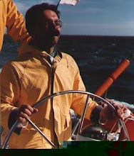
- También hay un vídeo con declaraciones del patrón Chris Nicholson.
En mi opinión la explicación de Chris Nicholson deja mucho que desear. Viene a decir que su navegante le indica que la profundidad pasa de 3.000 a 40 metros en Cargados Carajos. El patrón comenta que como no hay corrientes, habrá que estar atentos a la altura de las olas.
Por su parte el navegante, Wouter Verbraak, comenta que utilizó una escala inadecuada en su carta de navegación electrónica: debería haber ampliado más.
En el vídeo muestran 2 niveles de zoom de la zona (que desconozco si esa parte proviene del sitio oficial de la Volvo Ocean Race o es un montaje añadido por Destopnews).
En ambos niveles he repintado en rojo (para que se vea mejor), su último waypoint, que se situaba a 5,82 nm con 263º de demora magnética.
La disculpa es increible: no conozco las instrucciones de ese programa de navegación electrónica, pero meterse en la zona azul, o rozar la parte Este del objeto verdoso reseñado ya da temblores. Porque supongo habrían leido algo como lo indicado en algún derrotero, como por ejemplo el EnRoute 171 East Africa (pdf - 5 MB).
Cargados Carajos Shoals (16°38'S., 59°36'E.) is an extensive group of reefs, islets, and shoals. They have been reported to lie about 3 miles further SW than charted. The E side of the reef has not been closely examined, because it is almost impossible to approach it from the E; in addition to the tremendous sea always breaking over it, is reported to be steep-to, and, therefore, most dangerous to approach under any circumstance.Parece ser que Wouter Verbraak ya ha hecho algunos comentarios, que copio a continuación:
We finally have means of communications again, so a message is highly overdue…
I am totally devastated and still in shock as the gravity of our grounding is slowly sinking in now that we are safely in Mauritius with finally some time to reflect on what happened.
We are very lucky that nobody was hurt, and a lot of that is credit to our teamwork in the seconds, minutes and hours after the crash.
I made a big mistake, but then we didn’t make any others even though there were many difficult decision to be made and the situation was very challenging and grave indeed.
Once I can get power to the boat’s laptops (if they survived) I can look further into how we didn’t see the reef on the electronic charts. I did check the area on the electronic chart before putting my head down for a rest after a very long day negotiating the tropical storm, and what I saw was depths of 42 and 80m indicated. There is a very good article posted here which highlights some of the zooming problem in the vectorised charts that we used.
I can assure you that before every leg we diligently look at our route before we leave and I use both Google Earth, paper charts and other tools. However, our planned route changed just before we left, and with the focus on the start and the tricky conditions, I erroneously thought I would have enough information with me to look at the changes in our route as we went along. I was wrong. I am not trying to make any excuses – just trying to offer up some form of explanation and answer to some of your questions.
There are a number of lessons to be learned from this, which we hope will be able to relay in the time to come.
I am immensely grateful for all the support that we as a team, my family and myself have received from our wonderful friends, colleagues, family, Vestas, Powerhouse and Volvo. More over we are heavily in debt to the thorough support of Alvimedica throughout the first night, as well as the local fisherman and the coastguard of Ile du Sud in the atoll. So I want to thank everybody so very much. Thank you, thank you, thank you.
I am forever in your debt.
Continuará.
- - -


No hay comentarios:
Publicar un comentario