No he encontrado información sobre el puerto de salida en la isla de Texel, pero podría haber sido Oudeschild. Está abrigado de vientos del oeste y protegido del Mar del Norte por la propia isla.
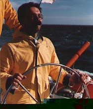
[ Fotógrafo: Dick Heuff ]
El bueno de Juet dice que como el viaje es conocido, pasa directamente al Cabo Norte.
ON Saturday the fiue and twentieth of March, 1609, after the old Account, we set sayle from Amsterdam; and by the seuen and twentieth day, we were downe at the Texel: and by twelue of the clock we were off the Land, it being East of vs two leagues off. And because it is a journey vsually knowne, I omit to put downe what passed, till we came to the height of The North Cape of Finmarke, which we did performe by the fift of May (stilo nouo) being Tuesday. On which day we obserued the height of the Pole, and found it to bee 71.degrees and 46.minutes; and found our Compasse to vary six degrees to the West: and at twelue of the clocke, the North Cape did beare South-west and by South, tenne leagues off, and we steered away East and by South, and East.En su blog, Henry detalla algo más su viaje. Habrá que verificarlo.
Pequeño detalle TIC. Recuerdo que con el GeoHack se puede acceder a muchos visualizadores georrefenciados. He hecho unas cuentas teniendo en cuenta que una legua (league) son unas 3 millas. Creo que he localizado la posición que describe Juet :-)
Introducir en GeoHack los siguientes datos: 71º34'24''N a 26º19'23''E, después elegir el visualizador ACME Mapper. Ajustar el zoom y posicionar el cursor en el Cabo Norte.
- - -


